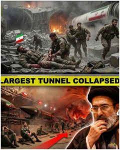
“THE DAY IRAN’S UNDERGROUND EMPIRE COLLAPSED” — What Satellite Images Really Reveal
The phrase sounds absolute—like a hidden world buried beneath mountains suddenly shattered in a single day. But when it comes to Iran’s vast underground military and nuclear infrastructure, the truth revealed by satellite imagery is both dramatic and deeply uncertain.
Yes, there has been damage. Yes, key sites have been hit.
But the idea of a total “collapse”? That’s far more complicated.
The Hidden World Beneath Iran
For decades, Iran has invested heavily in building what analysts often call an “underground empire.”
These facilities include:
-
Uranium enrichment halls buried deep underground
-
Missile storage tunnels carved into mountains
-
Command bunkers designed to survive airstrikes
The most well-known sites—Fordow, Natanz, and Isfahan—are not ordinary facilities. Some are buried tens to over 100 meters beneath rock, reinforced with concrete and steel, specifically designed to withstand even the most powerful bombs.
This is why they exist underground in the first place:
to survive exactly the kind of strikes that are now hitting them.
What Satellite Images Actually Show
Recent satellite analysis has provided rare insight into what’s happening on the ground—especially as access inside Iran remains limited.
Across multiple sites, imagery reveals:
1. Craters and Penetration Points
At facilities like Fordow and Natanz:
-
Large craters appeared directly above underground halls
-
Entry holes from bunker-buster bombs were visible
-
Mountain ridges show signs of direct impact
These are not random hits—they are precision strikes targeting what lies beneath.
2. Destroyed Surface Infrastructure
Satellite data confirms:
-
Buildings flattened or heavily damaged
-
Power supply systems knocked out
-
Support facilities reduced to debris
At Natanz, above-ground infrastructure critical to enrichment operations was severely damaged or destroyed, disrupting operations even if underground sections remained intact.
3. Blocked Tunnel Entrances
One of the most significant findings:
-
Tunnel entrances appear buried or sealed
-
Roads leading to underground access points disrupted
This matters because underground facilities are only useful if they can be accessed. Blocking entrances can temporarily neutralize a site without fully destroying it.
4. Widespread Damage Across the Country
Satellite radar comparisons show:
-
Hundreds of damaged structures nationwide
-
Multiple cities affected simultaneously
-
Strategic sites hit across different regions
One analysis identified over 800 damaged locations in a short time frame, highlighting the scale of the campaign.
But Here’s the Critical Reality: Underground Damage Is Hard to See
Satellite imagery has limits.
It can clearly show:
-
Surface destruction
-
Craters
-
Structural collapse above ground
But what it cannot reliably show is:
-
The condition of deep underground chambers
-
Whether centrifuges or equipment were destroyed
-
The extent of internal structural collapse
Even international निरीctors acknowledge that the true state of underground facilities remains uncertain and may require physical inspection to confirm.
Did Iran’s “Underground Empire” Collapse?
This is where headlines and reality diverge.
✔ What likely happened:
-
Significant damage to entrances and support systems
-
Possible destruction of some underground equipment
-
Major disruption to operations
❌ What is not confirmed:
-
Total destruction of all underground facilities
-
Complete collapse of deeply buried structures
-
Permanent elimination of Iran’s capabilities
Experts note that even powerful bunker-buster bombs do not guarantee full destruction, especially against facilities built specifically to withstand them.
Signs of Preparation—and Survival
Satellite imagery has also revealed something unexpected:
Before and after strikes:
-
Trucks were seen moving near key sites
-
Equipment may have been relocated
-
Tunnel entrances were sometimes sealed in advance
This suggests Iran may have:
-
Anticipated attacks
-
Moved critical materials
-
Protected sensitive assets before impact
In other words, the “underground empire” may have been partially evacuated before being hit.
The Scale of the Campaign
This is not about one site or one strike.
The broader military campaign has:
-
Hit thousands of targets
-
Damaged infrastructure across multiple cities
-
Expanded beyond nuclear facilities into military and industrial zones
Satellite analysis shows that destruction is distributed, not concentrated—a sign of a coordinated, large-scale operation rather than a single निर्णायक blow.
The Illusion of Instant Collapse
Why do headlines claim a total collapse?
Because:
-
Underground facilities are mysterious
-
Satellite images show dramatic surface damage
-
The idea of a hidden network being destroyed is compelling
But reality doesn’t work that way.
Underground systems are built for resilience:
-
Multiple layers of protection
-
Redundant tunnels
-
Dispersed infrastructure
Even if one section is destroyed, others may survive.
What This Means Strategically
The strikes have likely:
-
Slowed Iran’s nuclear and military programs
-
Disrupted operations
-
Forced relocation and rebuilding
But they have not necessarily:
-
Ended those programs
-
Eliminated technical knowledge
-
Removed long-term capabilities
In fact, history shows such programs often adapt and rebuild after setbacks.
A War of Visibility—and Secrecy
Another key factor: information itself is limited.
-
Satellite access has been restricted in some cases
-
Internet blackouts limit on-the-ground reporting
-
Both sides control narratives
This creates a situation where:
images tell part of the story—but not all of it
Final Reality Check
The phrase “the day Iran’s underground empire collapsed” is powerful—but misleading.
Here’s the clearer picture:
✔ Satellite images confirm significant damage
✔ Key nuclear and military sites have been hit hard
✔ Access points and infrastructure have been disrupted
❌ No confirmed evidence of total underground collapse
❌ No proof that all facilities were destroyed
❌ No indication the system is permanently gone
Conclusion
Satellite imagery has pulled back the curtain on one of the most secretive military infrastructures in the world. It shows impact, القوة, and precision—but also uncertainty.
What lies beneath the surface—literally—remains partially hidden.
And that’s the real story:
Not a complete collapse, but a battle between destruction and resilience, playing out in tunnels, bunkers, and buried networks that no satellite can fully reveal.